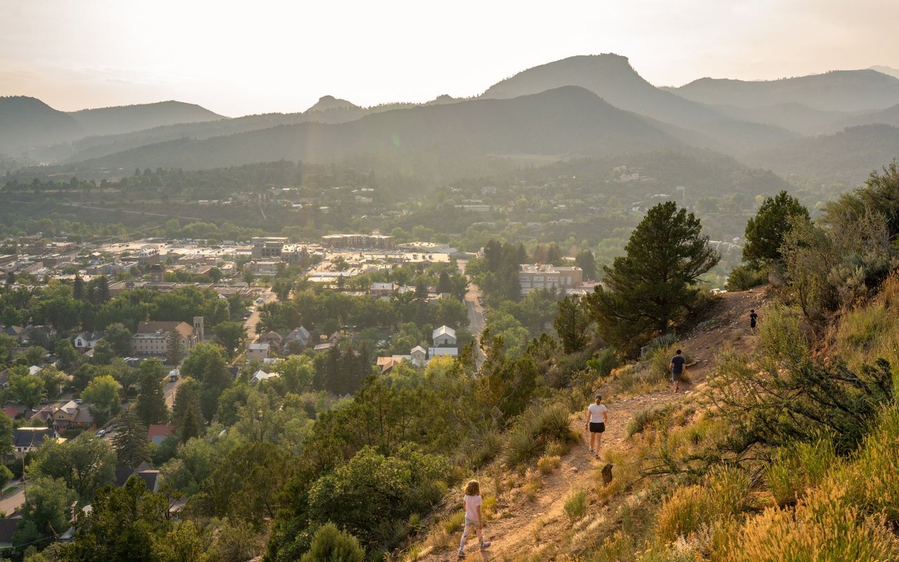
On the west side of Durango, mid-October through November is the most open stretch of the year on the trails. The part of Perins Peak State Wildlife Area east of La Plata County Road 208 is open to the public only from August 1 through November 30. Every other month it's closed. On December 1 that side closes again, and so do the upper trails at Twin Buttes. As of today, October 13, that's about seven weeks away. One rule for dog owners has already changed, and a lot of people haven't noticed.
Fall Is When the West Side Has the Most Open Ground
The trails off US 160 West follow two calendars. The City of Durango manages Twin Buttes Open Space. Colorado Parks and Wildlife manages Perins Peak. Line their dates up and you can see how short the fully open period is.
| Area | Closed to the public | Open | Pet dogs allowed |
|---|---|---|---|
| Perins Peak SWA, west of CR 208 | Dec. 1 to April 30, except turkey hunters | May 1 to Nov. 30 | On leash, May 1 to Sept. 30 |
| Perins Peak SWA, east of CR 208 | Dec. 1 to July 31 | Aug. 1 to Nov. 30 | On leash, Aug. 1 to Sept. 30 |
| Twin Buttes, upper trails as marked | Dec. 1 to mid-spring | Mid-spring to Nov. 30 | Follow City open space rules |
| Twin Buttes, lower trails | Open year-round | Year-round | Follow City open space rules |
The Perins Peak dates come from the CPW Chapter 9 regulations approved in May 2026. The Twin Buttes split comes from the City's winter closure map, which shows the closure taking effect December 1.
From August through November, both sides of Perins Peak and all of Twin Buttes are open together. That's the only time of year it happens, and the last part of that window is now.
Perins Peak Runs on Two Clocks, Split by County Road 208
County Road 208 divides Perins Peak, and the two sides close for different reasons. Colorado Parks and Wildlife describes the Perins Peak State Wildlife Area as winter range for deer and elk and as a site of a peregrine falcon recovery and release program. The December through April closure on the west side is for wintering animals. The closure east of the road runs until July 31 because that's where the falcons nest. Durango Trails describes that closure as covering the Perins Peak area east of County Road 208 and west of Hogsback, there to protect nesting peregrines. The BLM's Tres Rios Field Office closures page describes the same boundary.
Put the two sides together. West of the road is open seven months a year. East of the road is open four, and the falcons' nesting season takes up most of the warm weather. Someone who waits for a cool fall weekend to go east of CR 208 has until the end of November.
Perins Peak isn't a city park. It's a state wildlife area, and Colorado's wildlife area rules require anyone 16 or older to carry a current hunting or fishing license or a Colorado State Wildlife Area pass. The rules also prohibit entering areas posted as closed. Many people treat Perins Peak like the open space next door, and this requirement is easy to miss.
The Dog Rule Changed on October 1
People who walk their dogs here are most likely to get caught by this one.
Leashed dogs are allowed on Perins Peak west of CR 208 from May 1 through September 30, and east of the road from August 1 through September 30. From October 1 through November 30, the regulation allows dogs only under CPW rule #900(C)(15). In Colorado's wildlife area rules, #900(C)(15) generally bars dogs, cats and other pets from CPW wildlife properties. The exceptions are dogs actively hunting, dogs being trained for hunting, dogs in field trials licensed by the Division, and qualifying service animals.
So during the fall weeks when Perins Peak is most open to people, pet dogs aren't allowed. A leashed walk that followed the rules on September 30 doesn't on October 1. On December 1, public access closes on both sides of the road, except for turkey hunters west of CR 208.
This is general information about how the CPW rules are written, not legal advice. Before heading out, check the current regulations and the posted signs, or call Colorado Parks and Wildlife.
Twin Buttes Splits by Elevation
At Twin Buttes, the closure line follows elevation, not a road. The City describes the open space as 580 acres with about 10 miles of trail. Durango Trails' Twin Buttes system page lists Cliffrock Loop, Lightner Creek Trail, Twin Buttes East, Twin Buttes Trail, Mid Traverse, Lower and Upper BC & F, Lower and Upper Ed & Flo, and The Buttes. It names Ed and Flo as the featured trail for its "twisty and whoopy turns."
The City's winter map labels Cliffrock Loop and the upper routes inside the closure area. It gives the reason for the closure in one sentence:
"Trails are closed during winter seasons in order to protect critical habitat that is necessary for wildlife in winter months when food is scarce and recreation can impact their survival."
In its November 30, 2025 closure notice, the City described the closed area as "the upper open space area and trails as marked." Durango Trails says the lower Twin Buttes trails stay open and are reached from US 160 West. None of the sources we reviewed lists which lower trails stay open by name. The signs at each junction decide, so look for them.
Access stays the same all winter. The main east trailhead is a dirt lot on the north side of US 160, about 1.5 miles west of town next to the Speedway station. A second access trail starts on Lightner Creek Road, County Road 207, and heads east toward the main entry.
Where West-Side Miles Go After December 1
The closures cover a lot of the west side, but plenty stays open. The City's 2025 notice lists the winter closures. Durango Trails lists the trails that stay open, and these are the ones closest to US 160 West:
- Lower Twin Buttes, from the US 160 West trailhead, with the upper loops closed.
- Overend Mountain Park, with access from Leyden Street, Montview Parkway, Crestview Drive and Hidden Valley Circle.
- The Colorado Trail from the Junction Creek access.
- All of Dalla Mountain Park, from Junction Creek Road.
- Smelter Mountain Trail at Bodo State Wildlife Area, the one exception to the Bodo closure. It's open 10 a.m. to 2 p.m., and dogs aren't allowed.
The Durango Trails list of open trails was published in 2023. The City's 2025 closure list matches it on Twin Buttes and Bodo, but we didn't find a 2026 announcement, so treat the list as a guide until the new season's notice confirms it.
The City's notice also asks for something on the trails that stay open. "Please consider alternative locations or activities during muddy conditions to prevent trail damage," it says, and it asks people to watch wildlife from a distance and keep dogs under control at all times. In early winter, the trails that stay open get extra traffic from people whose usual routes just closed.
The Connector Has No Confirmed Opening
The status of one planned change at Twin Buttes is unclear. The City of Durango and Durango Trails have proposed a new singletrack between Cliffrock Loop and Upper Twin Buttes. Right now the only way between those two trails is what the City's Engage Durango project page calls "a fun, but rather advanced downhill and a stout and technical climb." The new route would follow a gentler, winding line past the cliffrock formation above the eastern meadows. It's also part of the City's effort to add trails open to Class 1 e-bikes.
According to the same page, equipment failures in 2025 and a shortage of workers pushed construction to spring 2026, after the winter closure. It gave an estimated completion date of July 4, 2026. We couldn't find any confirmation that the trail was built or opened. Its route runs through the upper area that closes December 1, so construction there depends on the same seasonal calendar as everyone else.
When the Upper Trails Reopen
Every source starts the closures on December 1, and they give different reopening dates. The City's Twin Buttes map lists April 15. The City's November 2025 notice said the area-wide closures would run through May 1. The CPW roundup that the Pagosa Daily Post ran on December 1, 2025 listed Perins Peak as closed through April 30, with the east side closed through July 31. Durango Trails has described the end date as April 15 or 30 depending on weather. Last season, the City posted its notice on November 30, 2025. Durango Trails' trail conditions page posts updates through the winter.
Until then, the east side of Perins Peak is open, the upper Twin Buttes trails are open, and Ed and Flo is open from top to bottom, through November 30.
Questions about which trails stay open in winter, or about access to open space on a particular West Durango property, come up often with our clients. Alicia Romero is happy to walk through what's near a home you're considering or one you already own. If you're curious what your West Durango home is worth this season, request a home valuation and start the conversation.